
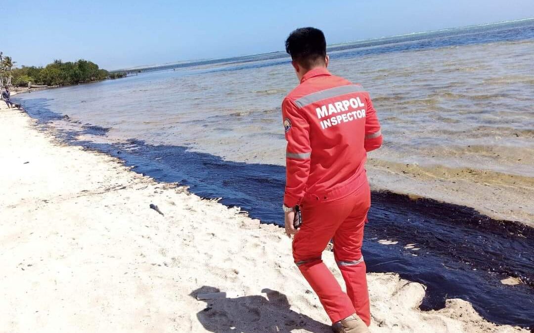
The tanker Princess Empress, which sank off the Philippines on 28 February, is still leaking oil, with the spill endangering more islands. The Department of Environment and Natural Resources (DENR) has meanwhile reported it has likely found the location of the wreck at 400 metres below sea level.
The Princess Empress departed from Bataan en route to Iloilo with twenty crew members (including the master) and approximately 800,000 liters of industrial fuel oil on board. It then encountered engine trouble due to overheating. The crew was evacuated and the tanker then sank.
Also read: Philippines launches oil spill response after tanker sinks
Oil spill
The DENR reports it continues its interventions to tackle the subsequent oil spill. So far, the spill has affected around ten municipalities, but it could also reach other coastal islands, including Palawan, Antique and Romblon.
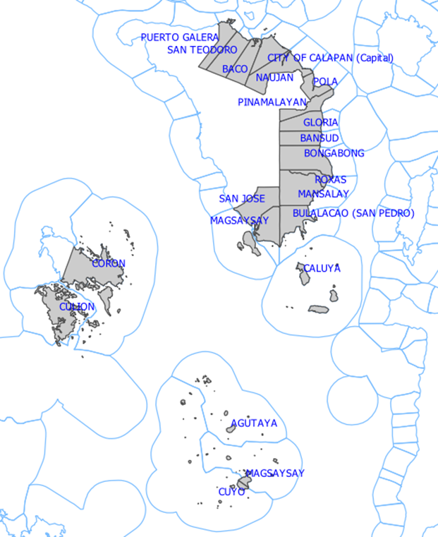
Using modelled oil spill trajectories, the University of the Philippines’ Marine Science Institute (UP-MSI), the projected spill will continue due south west to Cuyo group of islands and will get closer to northern Palawan mainland around 12 March. The UP-MSI approximates that 20,000 ha of coral reef, 9900 ha of mangroves and 6000 ha of seagrass may be affected by the oil slick in the municipalities seen in the picture below. More than half of potentially affected reefs (11,000 ha) are found in the Cuyo group of islands.
The Philippine Coast Guard remains the lead organisation in tackling the oil spill, but companies such as Shell, Prime Energy, Petron, First Gen, and the Ayala Group have also offered help.
Location of the wreck
The DENR mobilised the survey vessel BRP Hydrographer Ventura on March 2, which was deployed to the site on March 4. Due to rough seas, they only arrived at the site early morning of March 5.
Through the efforts of BRP Hydrographer Ventura, the DENR says they may have detected the possible site where the vessel is actually located. That site is about 400 metres below sea level. The vessel is located about northeast of Pola, Oriental Mindoro. It is believed to have moved southeast from its last known position where it completely submerged.
The DENR now wants to verify the location through the use of a remotely-operated vehicle (ROV), which is to allow complete visualisation should the currents and weather permit.
The information regarding the location of the wreck is now also being used in the modelling for the spread of the oil.
Push for full investigation
In the meantime, expressing concerns over serious damage that the oil spill may bring to the environment and marine life, Cavite 4th District Representative Elpidio Barzaga Jr. on Tuesday, 7 March, pushed for a full investigation, in aid of legislation, of the incident.
Picture by the Philippine Coast Guard.